Marine Services :: Survey Technologies
DEA Marine Services owns and operates an expansive pool of state of the art survey equipment. We continuously invest in new data acquisition systems, survey vessels, and ancillary support equipment. As a leading marine survey consultant, we frequently assist manufacturers during their research and development so next generation technologies efficiently meet project requirements. This is part of our commitment to the advancement of the marine survey industry and to our clients.
Multibeam Sonar Bathymetry
Multibeam sonar systems are capable of providing full coverage with high-resolution soundings over a project area.
Learn more.
Single Beam Sonar Bathymetry
Single beam surveys use survey grade echo sounders that digitally log both a detected bottom depth and the full water column acoustic signal.
Learn more.
Laser Scanning
Laser scanning develops a very dense point cloud of an upland project area, which can be used to create detailed, high-resolution 3-D digital models.
Learn more.
Marine Services
- Precision Navigation and Nautical Charting
- Infrastructure Inspection
- Marine Design and Construction Support
- Flood Control and Reservoir Capacity Surveys
- Environmental Site Characterization
- Marine Geophysical Investigations
- Geospatial Analysis
- 3D Scanning
- Hydrographic Surveys
- Marine Services Projects
Related Projects
Multibeam Sonar Bathymetry
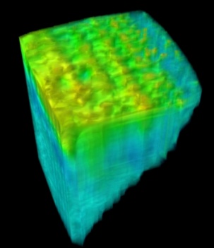
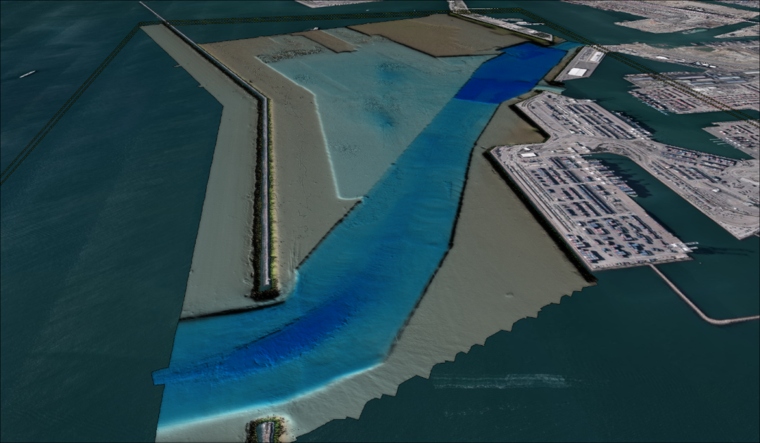
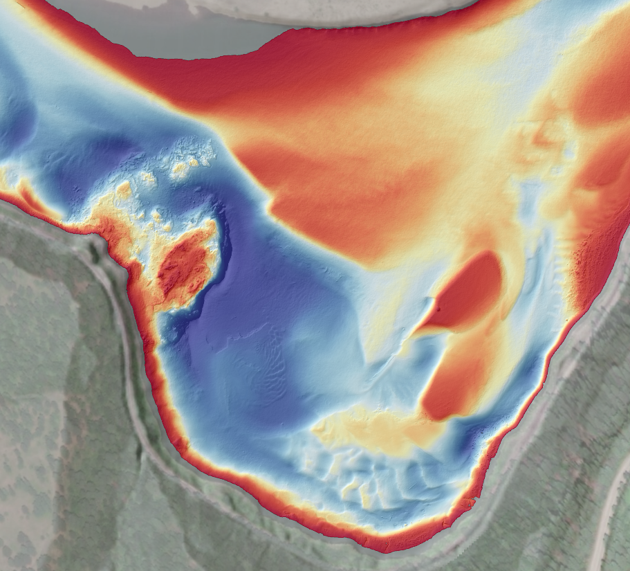
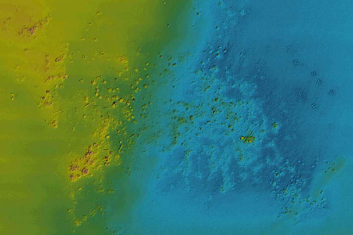
Multibeam sonar systems are capable of providing full coverage with high-resolution soundings over a project area. DEA owns some of the highest resolution multibeam systems available, which allow for high-density grid generation as fine as 10 cm. Narrow beam widths can record up to 512 individual soundings with each ping over a swath width of up to 165°, or compressed into a narrow swath width for increased resolution at depth.
All of our multibeam systems are equipped with backscatter and snippets options which can be used to generate mosaic imagery of the seafloor. This imagery can be used to delineate bottom substrate, locate debris, or visualize structures. In addition, our sonars have the ability to log full water column acoustic data, typically used for feature investigations.
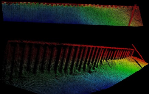
The image to the right depicts high-resolution multibeam data used to monitor the integrity of a submerged retaining wall. The data also detected a broken piling projecting into the waterway.
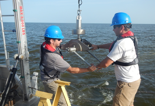
Single Beam Sonar Bathymetry
Single beam surveys use survey grade echo sounders that digitally log both a detected bottom depth and the full water column acoustic signal. Data are precisely positioned by GNSS with Real Time Kinematic (RTK) or Post-Processed Kinematic (PPK) techniques. This methodology improves overall survey vertical accuracy by capturing water level changes at the survey vessel, deviations in vessel height in the water due to squat and settlement from vessel speed fluctuations, and wave induced motion.
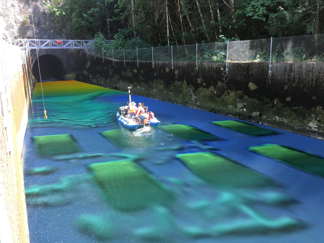
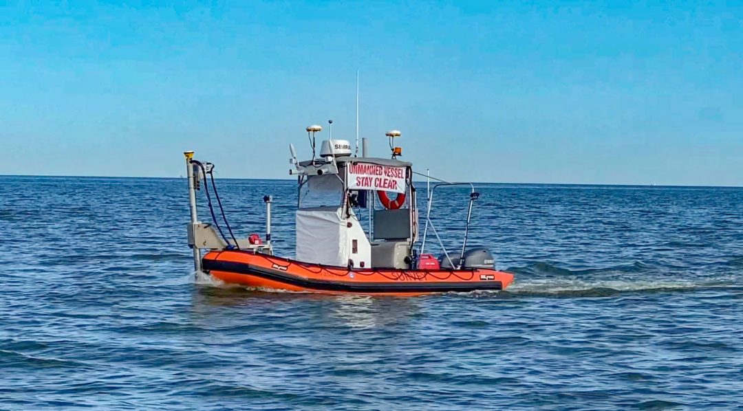
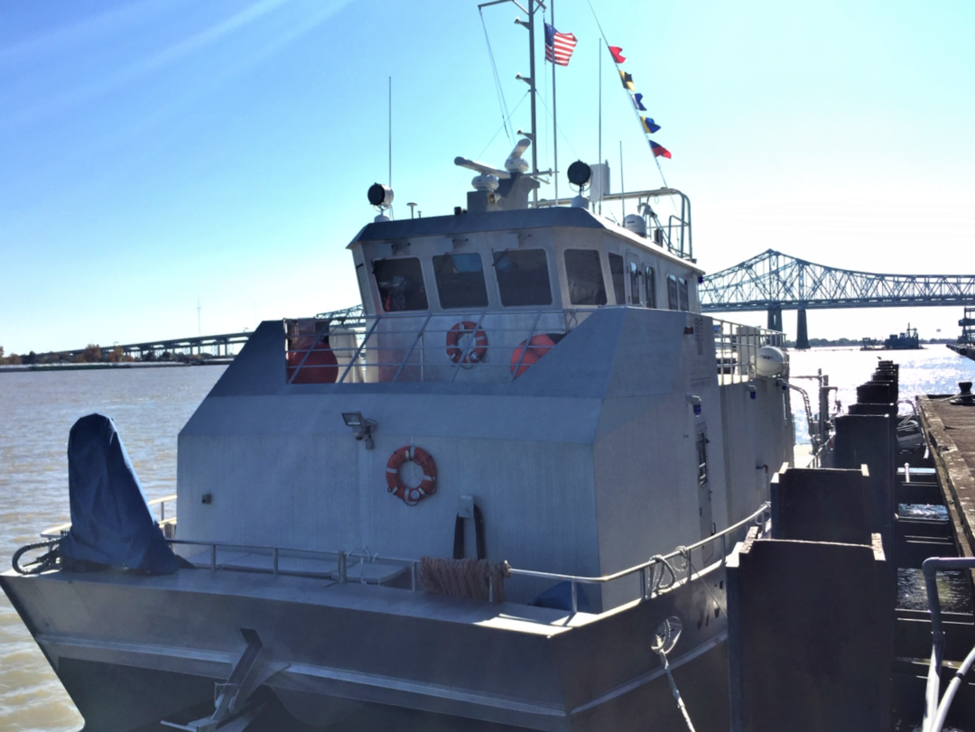
DEA owns several purpose built vessels to maximize productivity. In addition to vessels between 19’ to 33’, we have customized personal watercraft, jet powered whitewater rescue craft, catarafts, kayaks and remote operated platforms. Click on the image to the right for YouTube video demonstration.
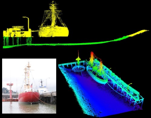
Laser Scanning
Laser scanning develops a very dense point cloud of an upland project area, which can be used to create detailed, high-resolution 3-D digital models. The abundance of data collected by this technology and the ability to integrate the results with other survey information makes laser scanning a cost effective tool for a variety of applications.
DEA Marine Services Division uses a vessel based laser scanner with a measurement rate of approximately 8,000 points per second interfaced with the vessel position and motion reference system.
A digital SLR camera with a fixed, calibrated lens aligned to the scanner with a precision mount allows georeferenced imagery to be collected concurrently with the scan data. Multibeam bathymetry can also be obtained alongside the scan data, allowing DEA to collect a very dense dataset from the seafloor to the top of bank in one pass. Combining mobile laser scanning with multibeam hydrography enables the generation of a fully integrated, hydrographic and topographic digital terrain model.
DEA’s Surveying and Geomatics Division utilizes several static topographic scanners as well as mobile terrestrial systems for high-definition 3D laser scanning, asset management, and infrastructure mapping.