Marine Services :: Hydrographic and Marine Geophysical Services
Hydrographic Surveys of Houston Ship Channel and Galveston Bay
Houston and Galveston, TX
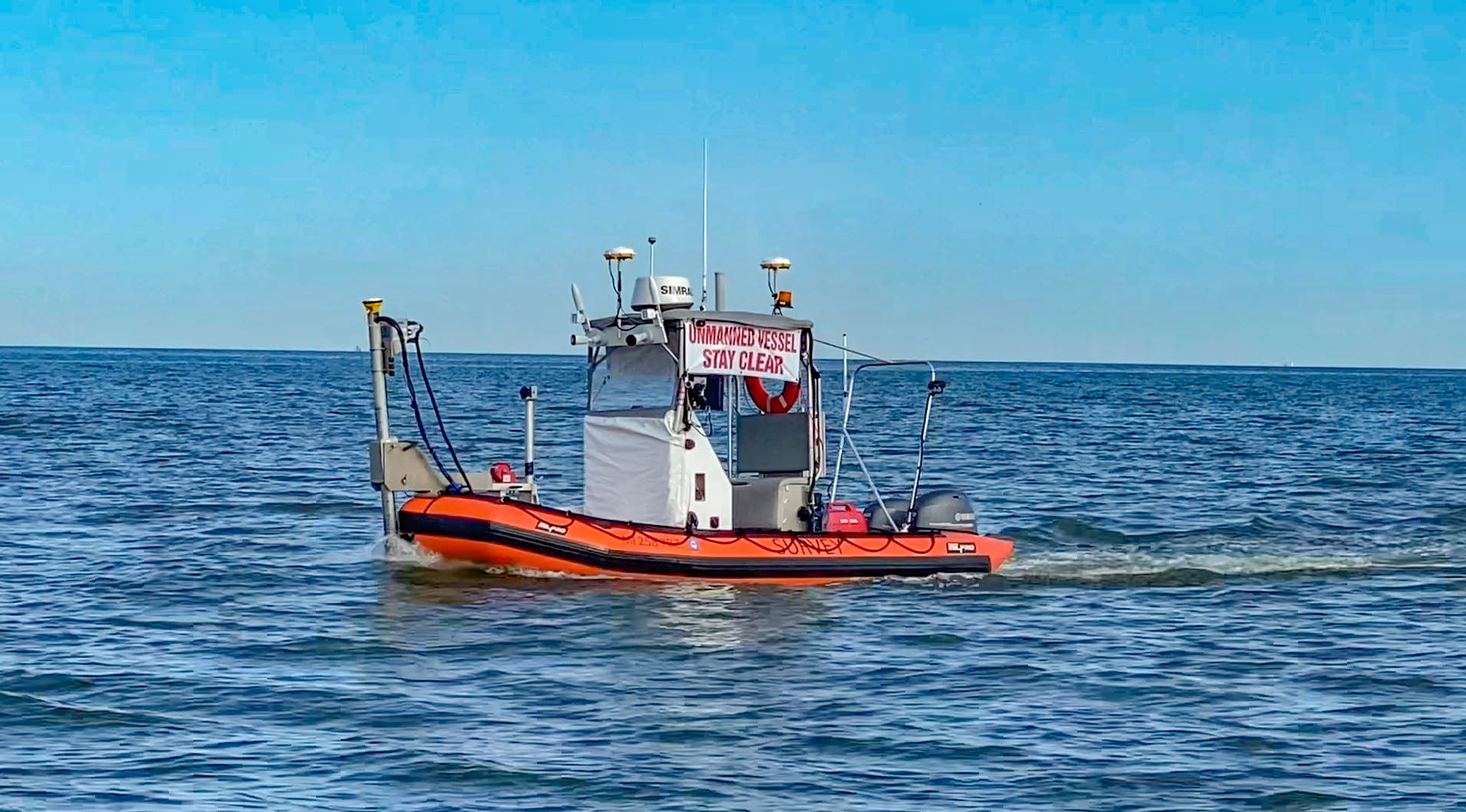
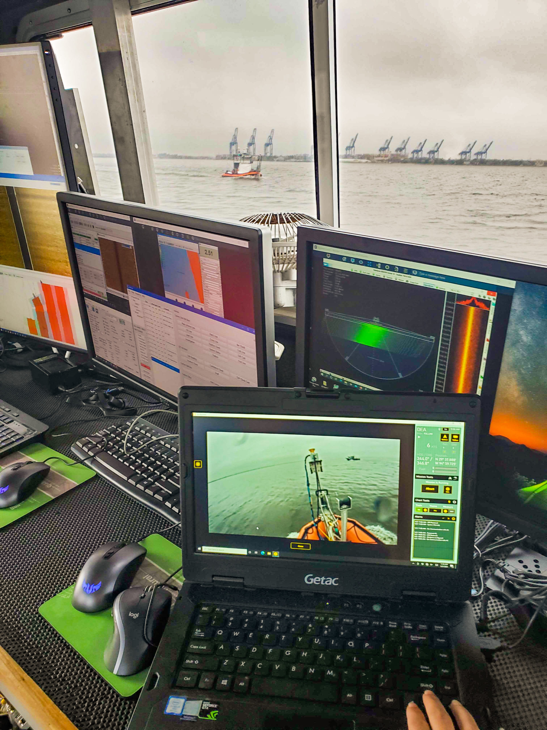
David Evans and Associates, Inc. (DEA) was contracted by NOAA Office of Coast Survey to perform high-resolution hydrographic surveys of the Houston Ship Channel and Western Galveston Bay, Texas. These surveys required the collection of more than 6,000 nautical miles of multibeam bathymetry throughout the project area in depths as shallow as two meters, some of which were surveyed with an unmanned vessel. In addition, DEA’s Survey Vessel Blake used a mobile mapping system to collect laser point clouds and imagery for over 120 nautical miles along the Port of Houston waterfront for detailed mapping of infrastructure, including terminals, bridges, and overhead cables.
DEA proposed several innovative solutions for this project to overcome challenges posed by vast expanses of shallow water within the survey area and the COVID-19 pandemic. These included a new coverage technique using imagery from dual-tilted multibeam sonars for the identification of critical bottom features; the use of an unmanned survey vessel; and remote oversight of field operations by DEA hydrographers working offsite.
More