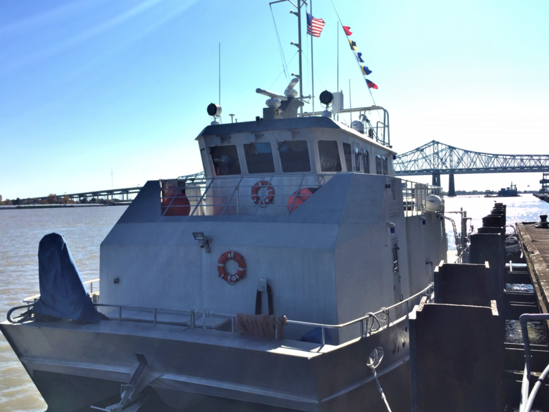
Marine Services :: Survey Applications
DEA Marine Services can tailor services to support a broad range of client needs. From designing customized field data acquisition plans and innovative data presentations to basic surveys, our staff is renowned for finding creative and cost effective solutions for the most challenging of projects.
Navigation and Nautical Charting
We have an extensive history of providing marine surveying and consulting services in support of navigation and nautical charting throughout the continental United States.
Learn more.
Infrastructure Inspection
We are on the forefront of high-resolution multibeam bathymetric survey technology to monitor underwater structures
Learn more.
Marine Design and Construction
Services for marine design and construction are customized to address project objectives.
Learn more.
Flood Control Studies
We provide single beam hydrographic surveys, water level observations, and Acoustic Doppler Current Profiler (ADCP) flow measurements for flood stage analysis.
Learn more.
Environmental Investigation
Environmental investigations cover a broad range of hydrographic, oceanographic, marine geophysical and associated geospatial services.
Learn more.
Marine Services
- Precision Navigation and Nautical Charting
- Infrastructure Inspection
- Marine Design and Construction Support
- Flood Control and Reservoir Capacity Surveys
- Environmental Site Characterization
- Marine Geophysical Investigations
- Geospatial Analysis
- 3D Scanning
- Hydrographic Surveys
- Marine Services Projects
Related Projects
Navigation and Nautical Charting
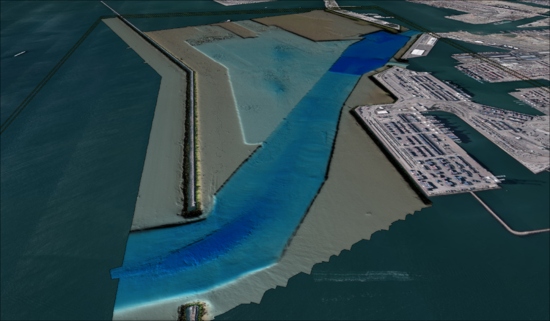
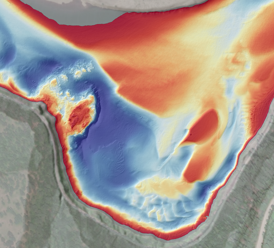
DEA Marine Services has an extensive history of providing marine surveying and consulting services in support of navigation and nautical charting throughout the continental United States. This work has included nautical charting surveys and consulting services for the National Oceanic and Atmospheric Administration (NOAA), the US Army Corps of Engineers (USACE), Port Authorities, Pilot Associations, and the maritime industry. DEA is integrating port survey and shoreline data into commercial ship pilot navigation software to improve safety of navigation on the Columbia River and working with charting authorities on hydrographic surveys of remote ports of call for Electronic Navigation Chart production.
DEA Marine Services’ support of navigation and nautical charting is exemplified by our ongoing surveying services to help address the nation’s critical survey backlog for nautical charting. Our current contracts with NOAA Office of Coast Survey include hydrographic services and airborne bathymetric LiDAR, spanning almost two decades of service to the nation. DEA’s surveying experience under these contracts includes the performance of multibeam and single beam hydrographic surveys; side scan sonar surveys; installation of water level stations; computation of tidal datums; deployment of GPS water level buoys; evaluation of VDatum and ellipsoidally referenced survey (ERS) techniques; extended 24-hour ship operations; and airborne bathymetric LiDAR operations.
The image on the right depicts NOAA’s 1957 partial coverage survey sheet (used on current nautical charts) presented with updated full coverage multibeam survey data collected by DEA. Most areas outside of the updated multibeam coverage by DEA are still charted with pre-1940′s partial coverage surveys.

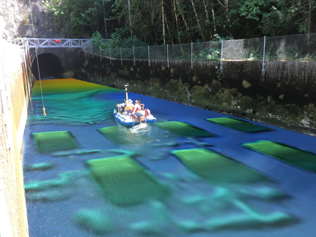
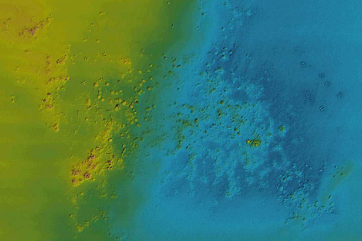
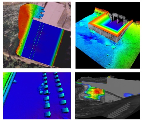
Infrastructure Inspection
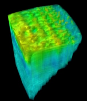
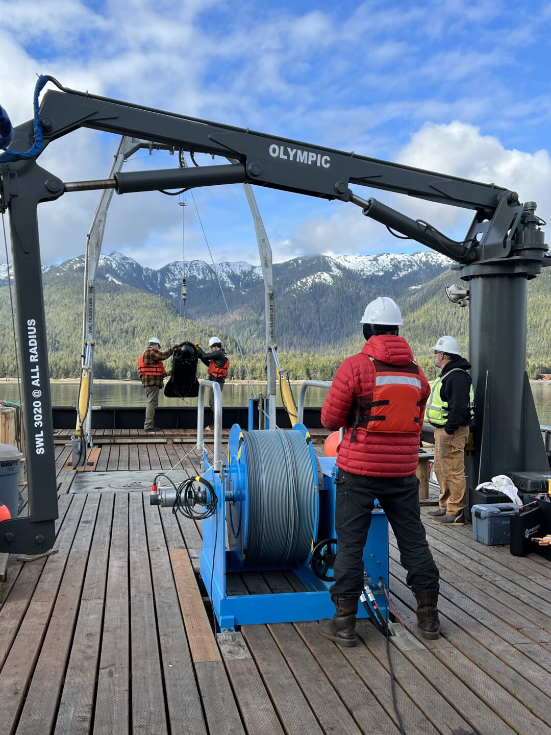
DEA has been on the forefront of high-resolution multibeam bathymetric survey technology to monitor underwater structures since the early 1990s. We evolved this service to monitor stilling basins, dams, and coastal navigation structures using a variety of methods including:
- Surfaced based high-resolution multibeam sonar
- Underwater scanning bathymetric sonar
- Remotely Operated Vehicle video inspections
- Above water high-definition laser scanning
- Subbottom profiling
- 3-D modeling
- Acoustic Doppler Current Profiling
These surveys have been performed for the US Army Corps of Engineers (USACE); the Waterways Experiment Station (now the ERDC Coastal and Hydraulics Laboratory); Hydro Power companies; Port Authorities; and State Departments of Transportation. The USACE mission of monitoring these structures and evaluating erosion areas before they become a problem requires quality data with highly accurate and precise horizontal and vertical positioning. DEA has been chosen to perform this work based on our demonstrated ability to fulfill USACE’s objective of precision monitoring.
Marine Design and Construction
Consistent, precise, and accurate data are vital to the success of any project, but critical for projects being constructed in marine environments. DEA frequently conducts surveys in support of the permitting, design, construction and post-construction inspection phases of marine projects in offshore, near shore, and inland waters.
Services for marine design and construction are customized to address project objectives and may include:
- Desktop studies of existing data
- Vessel traffic studies
- High-resolution multibeam seafloor mapping
- Side scan sonar seafloor imaging
- Subbottom profiling to map soft sediments
- Seismic reflection profiling to map geologic units
- Magnetic surveys to locate pipelines, cables, or wrecks
- Tide and current studies
- Sediment sampling
- Acoustic monitoring during pile driving
- Underwater positioning and monitoring during construction
- Geospatial services for mapping and modeling
Flood Control Studies
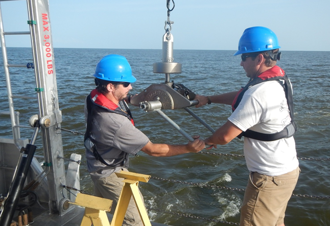
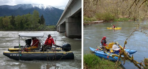
DEA provides single beam hydrographic surveys, water level observations, and Acoustic Doppler Current Profiler (ADCP) flow measurements for flood stage analysis.
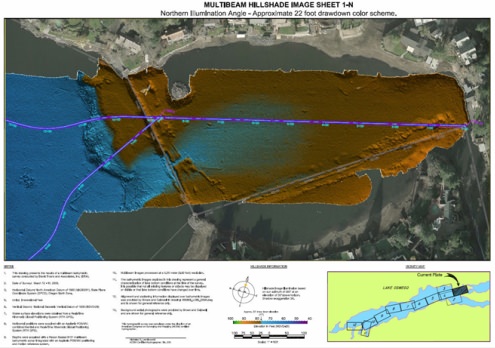
We run annual cross-section surveys on the Cowlitz River to monitor sediment transport from Mt. St. Helens runoff. Our cross-section surveys have supported flood analysis of the Willamette Valley, Snake River, and the Columbia Basin extending from the Pacific into Idaho and Montana. Detailed surveys of bridges are conducted to document restrictions for model input. Data is organized and compiled for direct entry into US Army Corps of Engineers (USACE) HEC-RAS. Each cross-section is photo documented and a geodatabase of photos is provided to aid modelers with roughness coefficient determinations.
Environmental Investigation
Marine and fresh waterways are unique natural environments for marine flora and fauna, and are critical assets to commerce, industry, and recreation. Maintaining and managing these crucial resources requires an understanding of their conditions, uses, and influences on both natural and man-made environments.
DEA Marine Services has the experience and technical resources necessary to support environmental investigations, document and monitor conditions using current and historic data, and aid in the remediation of contaminated marine sites.
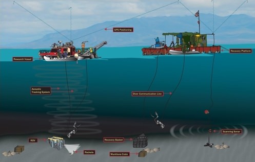
Environmental investigations cover a broad range of hydrographic, oceanographic, marine geophysical and associated geospatial services. Instrumentation and methodology are customized to meet specific project needs. Environmental investigations typically support:
- Remedial Investigations (RI)
- Feasibility Studies (FS)
- Habitat mapping (macrophytes, currents, tidal range, bathymetry, and substrate material)
- Sediment cap construction and monitoring
- Sediment transport studies
- Inundation modeling
- Derelict fishing gear remediation
- Unexploded ordnance remediation
- Marine archaeological investigations
- Tide and current studies
- Acoustic noise compliance monitoring during construction
- Baseline condition mapping and analysis