Marine Services :: Hydrographic and Marine Geophysical Services
DEA Marine Services provides hydrographic, bathymetric, and marine geophysical surveying services to local, state and federal government agencies, port authorities, utilities, and private industry. DEA is one of a select number of firms in the United States to have held several nationwide hydrographic services contracts with NOAA’s Office of Coast Survey, and one of just two firms selected by NOAA to provide airborne bathymetric LiDAR services. Our hydrographic surveying experience with USACE spans three decades and includes work with multiple Districts throughout the US. Work products developed by DEA have been used as examples in USACE manuals to demonstrate best practices.
Hydrographic Surveys
DEA Marine Services’ hydrographic surveying capabilities include high-resolution multibeam sonar, single beam sonar, and side scan sonar surveying services.
Learn more.
Marine Geophysical Investigations
We provide subbottom profiling, side scan sonar, and marine magnetometer surveying services.
Learn more.
Geospatial Services
We integrate geospatial data in a variety of two- and three-dimensional formats customized for project needs and client requirements.
Learn more.
Marine Services
- Precision Navigation and Nautical Charting
- Infrastructure Inspection
- Marine Design and Construction Support
- Flood Control and Reservoir Capacity Surveys
- Environmental Site Characterization
- Marine Geophysical Investigations
- Geospatial Analysis
- 3D Scanning
- Hydrographic Surveys
- Marine Services Projects
Related Projects
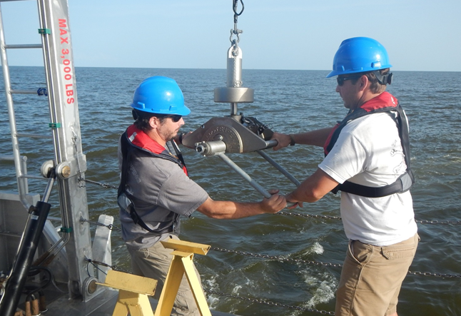
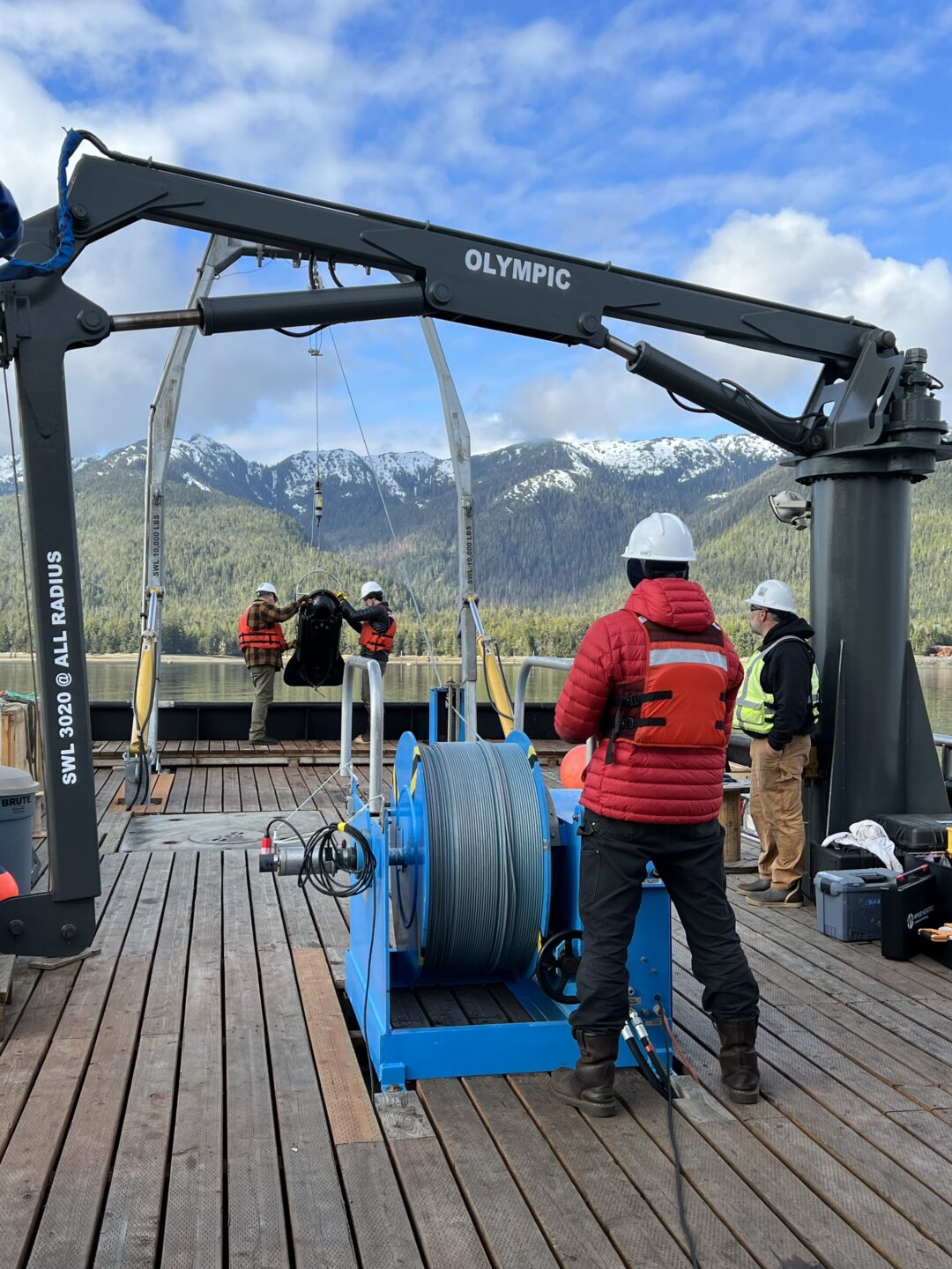
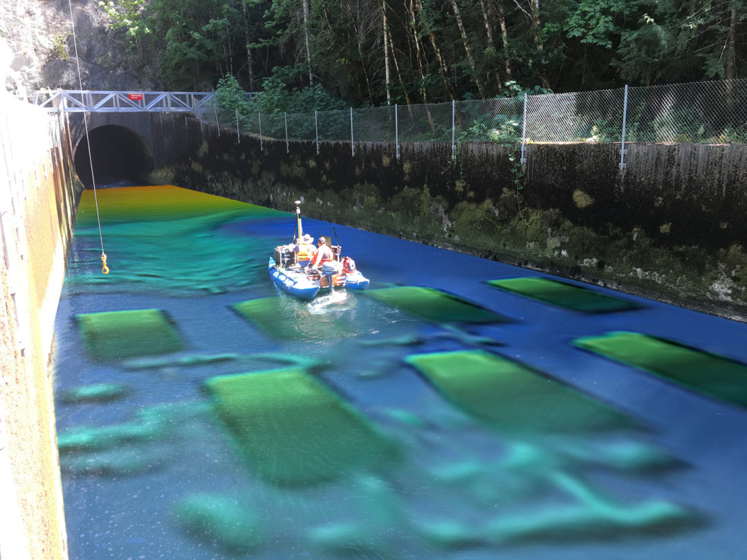
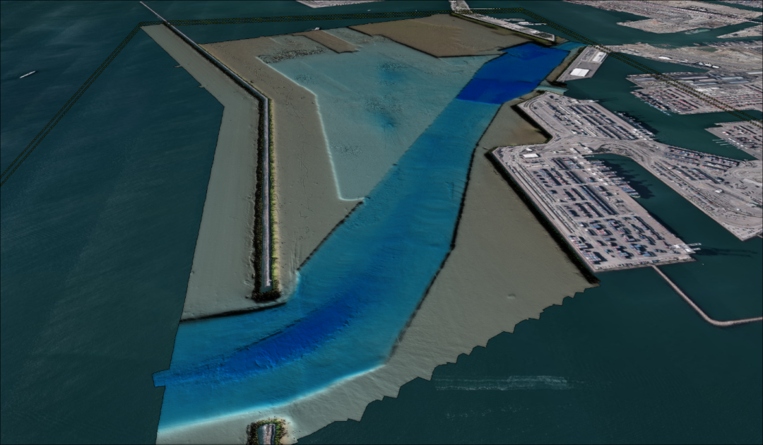

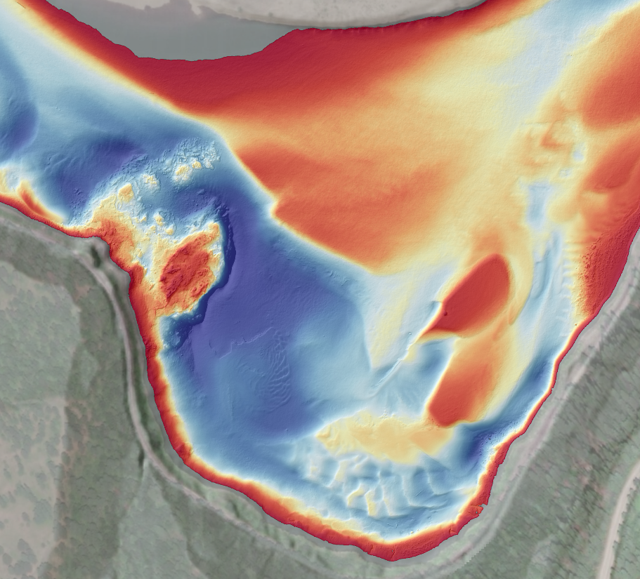
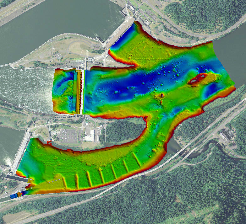
Hydrographic Surveys
DEA Marine Services’ hydrographic surveying capabilities include high-resolution multibeam sonar, single beam sonar, and side scan sonar surveying services. Our survey procedures follow standards set by the USACE, NOAA and IHO for Hydrographic Surveys as well as in-house developed procedures to maximize data quality. We routinely conduct surveys and deliver products exceeding these requirements and are able to customize our methods to meet our clients’ needs.
Marine Services personnel conduct hydrographic operations on a full time basis and are highly trained in all aspects of data acquisition and processing. Senior staff are peer recognized as national leaders in hydrographic sciences and are committed to advancing the profession of hydrography. Examples include: serving on the hydrographer certification board and the NOAA Hydrographic Services Peer Review Panel, authoring and presenting technical papers, and providing peer review and training to federal and local agency hydrographers.
DEA Marine Services’ staff includes Professional Land Surveyors, Professional Engineers, and Hydrographers certified by the National Society of Professional Surveyors and The Hydrographic Society of America (NSPS/THSOA).
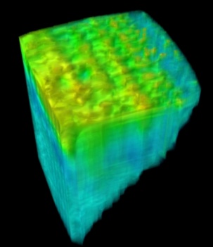
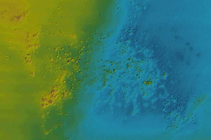
Marine Geophysical Investigations
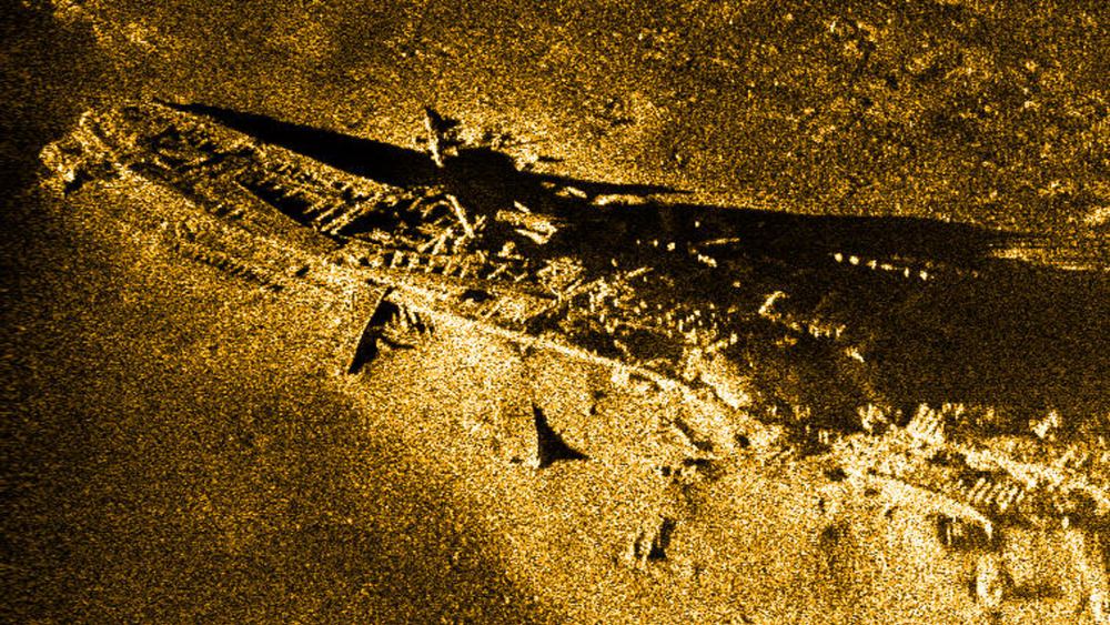
Marine geophysical investigations document underwater geology, providing a direct cost benefit to design and construction projects, dredge planning, and search and recovery missions. Meeting these objectives, DEA Marine Services provides subbottom profiling, side scan sonar, and marine magnetometer surveying services.
Subbottom profiling surveys map underwater subsurface geology using 3.5 to 24 kHz frequency profilers as well as seismic reflection or refraction technology. Ground penetrating radar (GPR) is also available for use in freshwater and other non-conductive environments.
Side scan sonar imaging surveys map underwater features, providing an acoustically generated image that can be used to characterize seafloor or riverbed features, identify obstructions projecting above the bottom that would impede or threaten navigation or construction, delineate bottom materials, or aid in search and recovery missions.
Magnetometer surveys measure the ambient magnetic field and can locate concentrated masses of ferrous material. These surveys are often used to locate ship anchors, buried pipelines, or investigate proposed cable and pipeline routes for cultural features.
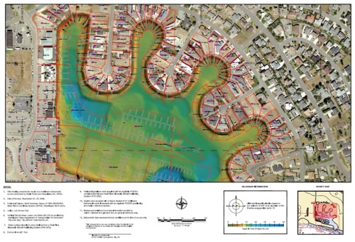
Geospatial Services
DEA integrates data in a variety of two- and three-dimensional formats customized for project needs and client requirements. Data products are provided via hard copy (paper) and on digital media in file formats compatible with current industry standards such as Esri ArcGIS, Bentley MicroStation, and Autodesk AutoCAD.
To add value to mapping products, DEA uses GIS as an integrated tool to help our clients and project managers organize, view, manage, and analyze their data. DEA applies advanced graphics, diverse database sets, and programming tools to mapping projects and holds or has access to large databases that can be used to support client projects.
DEA uses many GIS tools such as ArcGIS for Desktop, ArcGIS Pro, and ArcGIS Online. DEA staff can also access the full suite of extensions such as 3D Analyst and Spatial Analyst. Geospatial projects can include integrating information from AutoCAD Map, Manifold GIS, and Google Earth. Industry standard FGDC compliant metadata is provided to document the work for future use.
Furthering our commitment to providing geospatial services, DEA is now a Silver Tier Partner with Esri. The partnership enables our employees to offer industry leading GIS technology solutions and services to our clients.